GRATICULE
RouteFinda Web Service
Graticule's new RouteFinda web service lets subscribers upload a Microsoft Excel file with their own data, geocode postcodes, compute the shortest, or fastest, route and off-peak driving time between pairs of postcodes in Great Britain. Graticule's RouteFinda web service allows subscribers to process speadsheet files of their own data on a Pay Per Click basis. Subscribers pay a fee plus VAT. The fee entitles subscribers to process a number of records and to view online the status of their account. When they have used 90% of their subscription fee, they will receive an email reminder of the need to pay for a further subscription if they want to be able to continue processing their data using the service..The RouteFinda web service offers the following options.
- Geocode postcodes:
Takes 1 postcode - Returns the Easting and Northing co-ordinates in the National Grid of Great Britain for a postcode.
- Fastest Route:
Takes 2 postcodes - Returns driving distance in miles and kilometers and the off-peak driving time in hours and minutes between the two postcodes.
- Shortest Route:
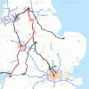
Takes 2 postcodes - Returns driving distance in miles and kilometers and off-peak driving time in hours and minutes btween teh two postcodes.FunctionsGraticule's RouteFinda web service lets a subscriber geocode postcodes in a field in the Excel spreadsheet by appending two additional fields for the Easting and Nothing co-ordinates in the National Grid of Great Britain.The web service also lets a subscriber compute the fastest or shortest route, distance in miles and kilometers and off-peak driving time in hours and minutes.A subscriber can upload an Excel spreadsheet file (*.XLS) with a list of postcodes for geocoding, process the data and append the Easting and Northing co-ordinates to each record and download the resulting Excel spreadsheet file (*.XLS). A subscriber can also upload an Excel spreadsheet file (*.XLS) with a FROM and a TO postcode in columns A and B as illustrated. He can then process his data using either the shortest or fastest route and get the results appended to each record as distance in miles and kilometers and off-peak driving time in hours and minutes (H:M). He can then download the results in an Excel spreadsheet file (*.XLS).Graticule's RouteFinda web service runs in a cloud and is expected to be available for 99% of time over the first year. Providing a subscriber has sufficient credit in his account to process the number of records in a file, the data will be processed.A SOAP and web front end are available. The web frontend can take lists of postcodes in an excel .xls file and do all the postcodes in a batch process.InputOutputBatch Processing Graticule's RouteFinda web server lets you process batches of data with up to 65000 records in an Excel Spreadsheet file(*.xls). The processing takes place on a virtual private server or cloud. Graticule's multi-threaded RouteFinda software is capable of simultaneously processing several jobs.RouteFinda software uses digital vector road map data and postcode points data of Great Britain. The data is revised periodically. The RouteFinda web service runs continually. Graticule monitors the service continually but can only fix any faults or bugs in the service during working hours from Monday to Friday.Free Trial Price of Subscriptions