GRATICULE
AptMap Vision
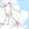
Great BritainGraticule's AptMap Vision software enables you to create high-quality colour maps on computers running 32-bit or 64 bit Microsoft Windows XP, Vista or 7 environments and other platforms.You can benefit by creating local, regional or national maps of Great Britain showing the location, geographical distributions and changes in these distributions over time.Supplied with high-quality, colour digital map data, the software includes a range of functions which are accessed via an intuitive and easy to use graphical user interface using point and click with a mouse. You can create attractive maps portraying your own business data such list outlets, customers, suppliers, employees, assets or other items for which you have either a postcode or Easting and Northing coordinates in the National Grid of Great Britain.How your business can benefit from using Aptmap Visison Software
- Supplied from Graticule's cloud server by electronic download over the Internet to your computer;
- Quick and easy to install using Graticule's new automated installing and licensing software on your computer;
- Supplied with high-qualtiy colour digital maps of Great Britain at two different scales and optionally with large-scale colour maps showing streets locally or nationally;
- Reads a spreadsheet or ASCII text comma separated value file with the name, address and postcodes of your contacts and plots the location of each on a map by a chosen map symbol;
- Enables you to create maps showing the residential location of outlets and customers, sales by product(s) or service(s) for a chosen period such as a month, quarter or year;
- Enables you to view, interpret, analyse and evaluate the location of customers by product or service, their geographical distributions and changes in these distributions over time and infer trends in your market, effects of competition and changes in shopping habits so you can adapt you strategic objectives and goals to stimulate growth in revenues and profits.
AptMap Vision software includes functions for reading vector and raster map data in a standard format, for displaying vector and raster colour or black and white digital maps, for manipulating data to select a geographical area of interest, for reading your contact address files and mapping the locations of each of your contacts by a map symbol of chosen shape, colour or size, for mapping your contacts by types on multiple map overlays, for saving map overlays, for creating high-quality colour maps with title, scale, legend and acknowledgements, for printing maps by saving them up to A3 size as an Acrobat file. Graticule designed and built AptMap Vision software using state-of-the-art, software engineering technologies and software libraries. The software is flexible, reliable, robust, extensible and portable. It includes a Help system, manual, tutorials and Quick Start Guides. The Help system includes instructions on how to use the software. Graticule provides technical support by email and telephone and can provide on-site or remote training at a daily charge rate and expenses. Contains Ordnance Survey data © Crown copyright and database right 2013.Contains Royal Mail data © Royal Mail copyright and database right 2013.Contains National Statistics data © Crown copyright and database right 2013. Features Flexible Mapping SystemAllows you to download, display, scroll over, change scale and print high-quality, colour maps of Great Britain;Map your own contactsAllows you to import and map the location by postcode of your own contacts in Great Britain;Multiple Types and Scales of Map DataAllows you to select area of interest, type and scales of map data and download data over the Internet;High Quality Colour Maps of Great BritainEnables you to create a comprehensive set of maps for personal or business use of Great Britain.