GRATICULE
PostcodeCalculator 2 Pro software
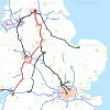
Graticule's PostcodeCalculator 2 Pro software lets you use postcodes in Great Britain to calculate straight-line distances or the shortest or fastest routes, driving distances in miles or kilometres and off-peak driving times in minutes between pairs of postcodes in Great Britain. It enables you to enter manually a From and To postcode in a table on screen and calculate results. You can run batch jobs with up to 65,000 postcode records by reading input data from a file and saving results to a file.
Graticule's PostcodeCalculator 2 Pro software has functions for performing several different types of calculations involving postcode unit points data of Great Britain:
- You can select to use either straight-line distance or driving distance by road between pairs of postcodes.
- You can select to use either the shortest route or quickest driving route by road between pairs of postcodes.
- You can select the Calc Single function to calculate the staight-line or shortest or fastest route by road between a \""From\"" a postcode\"" and \""To\"" a postcode i.e. finds the distance between single pair of postcodes or process a batch of pairs of postcodes by reading input and writing output to files. (one to one)
- You can select the Calc Multi function to calculate either straight-line distances or routes, distances and off-peak driving times \""From\"" one postcode such as a depot, outlet or school \""To\"" many home or outlet postcodes (One to Many)
- You can select the CompMulti function to calculate either the straight-line distances or routes, distances and off-peak driving times \""From\"" many depots or outlets \""To\"" many outlets or home postcodes (Many to Many)
- You can select the Nearest Outlet Nearest Customer function to find the nearest depot or outlet for a customer by using a file of all customer postcodes and a file of all depot postcodes. The results will show the nearest outlet postcode to a customer's home postcode.
- You can select the radial distance function for capturing all postcodes within a circle of a chosen radius in miles or kilometres about a chosen postcode which is the centre point or origin of a circle. Results give you a list of all postcode unit points which fall within the circle.
- The Postcode to Co-ordinates function enables you to capture the Easting and Northing and Longitude and Latitude co-ordinates in the National Grid of Great Britain in meters and in the World Geographical System (WGS84) in degrees. You can use this data to map the locations and geographical distributions of outlets or customers in Great Britain using mapping software. Batch results from PostcodeCalculator 2 Pro software
Excel spreadsheet input and output
You can create a spreadsheet file with two columns of postcodes. Give the first column a header such as \""Postcode1\"" and second column a header of \""Postcode2\"". Then enter the From and To postcodes of each trip by road under Postcode1 and Postcode2 respectively. Save the spreadsheet file as an .XLS file or an ASCII Text comma separated value (CSV) file.
Start PostcodeCalculator 2 Pro software by clicking on its icon on your Desktop. The default is the Calc Single function. Click on the Import File button and select your Excel Spreadsheet .XLS file. An import dialog box will appear on screen. Click on the top drop-down box arrow to select the Name of Table and Sheet to Look Up. The spreadsheet is called \""Sheet1$\"". The Postcode Field Name in the second drop down box is \""Postcode1\"" and in the third box \""Postcode2\"". Click on OK and your input data will appear in the table on screen. Under Preferences on the Menu, the default uses the shortest route so leave that as it is. Select the measurement units as miles. Select \""Use Road Distances\"". Click on \""Calculate\"". The results should appear in the table on screen. You can click on the Save button on the menu to save the results to an Excel spreadsheet .XLS file.
PostcodeCalculator 2 Pro software calculates distances and off-peak drive times between each pair of postcodes in your spreadsheet file and appends distances in miles and off-peak drive times in minutes to each record in your input file. You can have up to 65000 records in your spreadsheet.xls file. The results will appear on screen as they are calculated. You can scroll down to view all of the results. You click on Save on the menu to save the results to your spreadsheet file.
PostcodeCalculator 2 Pro sofware enables you to calculate the costs for each leg of a journey and to add up the total costs for a journey by road. All you have to do is multiply the distance by your business rate per mile or kilometer for your vehicle. For example, if your business rate per mile is £0.38 and the distance is 68.75 miles for one leg of the trip, the cost will be £25.75 for that leg. You can then add up the costs for a round journey from your home or office with several stops or visits to customers and back to your home or office. Batch jobs provide an efficient way of calculating your business transport costs by road every day, week or month.
PostcodeCalculator software can be used to estimate costs of delivering goods by road based on distances and estimated drive times and can assist in recovering transport costs, improve business efficiency and increase profitability.
PostcodeCalculator 2 Pro software runs on computers with Microsoft Windows 10,8,7, Vista or XP. Graticule sells single-user annual licences for the software with embedded postcode unit data and road network of Great Britain. The software is supplied by download from Graticule's cloud.
Please call Graticule's Sales Team if you would like to receive more information about PostcodeCalculator 2 Pro software and the price of a single user annual licence.
Features
| Straight-line or driving distance | Includes functions for straight-line distances and driving distance and off-peak driving time by road between two postcodes. |
| Radial search | Straight-line distances from chosen postcode to all postcodes within a circle of a chosen radius in miles; |
| How far is it? | Driving distance and driving time by road from a chosen postcode to all postcodes within a circle of a chosen radius in miles; |
| Road distance - Mileage | Calculates raod distance and off-peak driving time between pairs of postcodes in Great Britain. |
| Total Trip Mileage | Calculates the total distance in miles for a delivery vehicle with multiple drops or pickups in Great Britain for planning driving distance and driving time. |
| Data, Manual and Support | Includes postcode and vector map data, manual and technical support for 30 days from date of purchasing a software licence. |
Benefits
| Calculate distance from | Reads an Excel file with two columns of postcodes and returns a third column with straight-line distances in miles or kilometres.. |
| Calculate driving distances | Reads an Excel file with two columns of postcodes and returns a third column with driving distances in miles or kilometres.. |
| Estimate off-peak driving times | Reads an Excel file with two columns of postcodes and returns a third column with estimated off-peak driving times in hours. |
| Captures all customers near outlet | Reads an Excel file of postcodes and abstracts only those within a chosen radial distance in miles or kilometres of a chosen postcode such as an outlet or depot. |
| Processing capability | Can process Excel files with up to 65,000 records (32 bit limit) or more if using Excel for Windows 7 (64-bit) |
| Ease of use | Graphical user interface with table of your own data and derived data so you can save or cut and paste data into a spreadsheet. |
| Works with your data | Reads an Excel or ASCII text comma separated value file of your own postcodes and returns distances and driving times so you can calculate driving costs. |